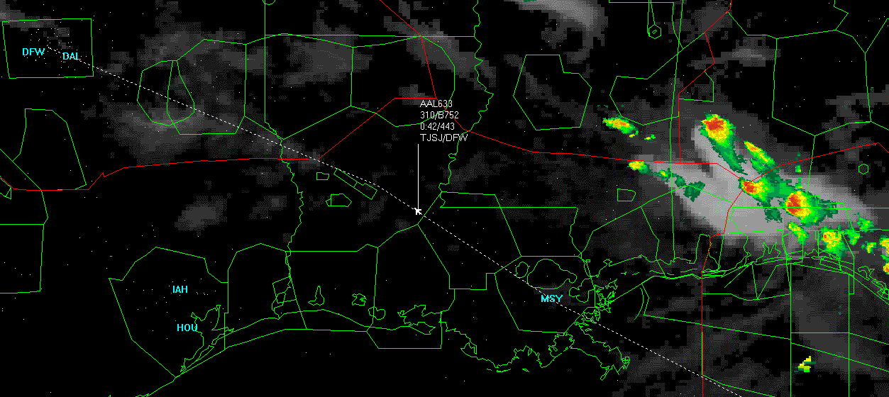
Where do you live? Louisiana? See attachment. This BBS doesn't allow truly large attachments, so I cut it down to just Louisiana. The fun looking colors on the right side and along the top are a composite input from our friendly neighborhood satellites. Those green big blobs are TRACONS, anything that flies within one of those bubbles can be seen to a 6 second resolution. The squarish smaller areas are some of the restricted zones. There are several levels of zone restrictions, if a plane enters one without permission they are not likely to make it back out. Each one of the white dots is an object flying in the air, be it plane, helicopter, whatever. As you can see, I am tracking the real time transit of flight AAL 633 to Dallas Fort Worth in Texas. Notice, the plane is flying precisely according to its indicated route. It passed over MSY and will pass very near the restricted area in a short bit. The tag (transponder response) indicates the plane is 42 minutes to landing cruisng at 44,300 feet, it is a boeing b-752.
There are various levels of drill available, for example, I can latch onto a private flight and pull up all sorts of information like you wouldn't believe. We monitor, record and track the entire north american airspace, and have records that go pretty far back as well.
So if you *really* want to know where your mom is or has been, I could tell you in two seconds. ;-)
Calvin
Attachments
89504-AAL633_flyover.gif (158 downloads)

 Previous Topic
 Index
Index
